
New Mexico Topographical Map
Static New Mexico Topo Map
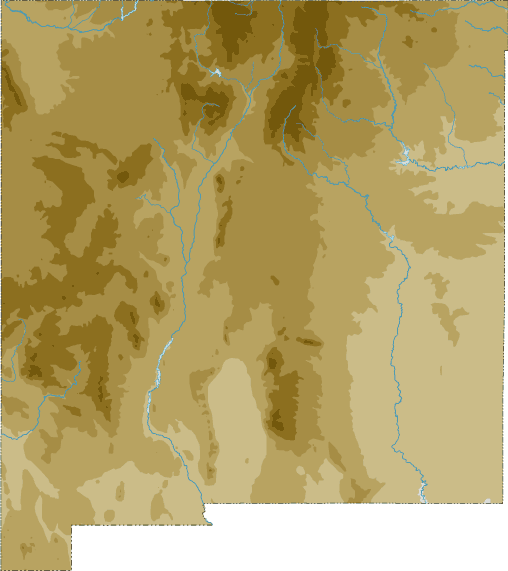
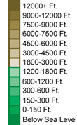
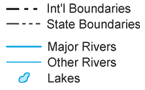
This section features a topographical map of New Mexico as well as a map legend that specifies elevation ranges and indicates their corresponding map colors.
Map Legend |
 |
|
 |
New Mexico Topographical Features
New Mexico's highest mountain is Wheeler Peak, whose peak is 13,161 feet above sea level. New Mexico's lowest elevation is 2,842 feet above sea level, at the Red Bluff Reservoir. Much of New Mexico features rugged terrain, rising from the Great Plains in the east. The Rockies are in the north, Sangre de Cristo Mountains northeast, Guadalupe Mountains southeast, and San Andres Mountains southwest. Major rivers in New Mexico include the Rio Grande, Pecos, Canadian, San Juan, and Gila.Interactive New Mexico Topo Map
This section features a topographical map that can be zoomed and panned to show the entire State of New Mexico or a small portion of the state. To zoom in or out on the map, use the plus (+) button or the minus (-) button, respectively. To pan the map in any direction, simply swipe it or drag it in that direction. At high zoom levels, the contour lines on this New Mexico map can help outdoorsmen, land developers, and others to plan their routes and activities more efficiently.
Copyright © 2005-2024 State-Maps.org. All rights reserved.
New-Mexico-Map.org is a State Maps reference source.
New-Mexico-Map.org is a State Maps reference source.